LiDAR Makes Waves in Engineering
Out with human surveying teams slogging across a project site to map a floodplain and in with slick UAV (unmanned aerial vehicle or drone) performing photogrammetry and collecting millions of elevation points in a matter of minutes. With the growing sophistication and cost-efficiencies of UAVs, the technologies of photogrammetry, lidar (Light detection and ranging) and UAV converge to provide infinite applications in surveying, civil engineering, construction and other fields. From a civil engineer’s standpoint, the collection of precise orthophotos and 3D elevation data via drone means spatial data for civil engineering projects can be assembled within hours instead of weeks. The ability to create a precise 3D terrain model is real and powerful. But with access to millions of data points in a blink of an eye, should engineers kick back and head for the break room? Of course, the answer is no. Even with robust lidar data, models are not always accurate models and the engineer’s responsibility to “truth-test” the data is ever present. That being said, lidar is an amazing tool. Here are a few things to know about the possibilities.
The Marvel that is Lidar
Lidar stands for high-density LIght Detection And Ranging. The remote sensing instrumentation can be mounted on a ground-based platform (Terrestrial Laser Scanning or TLS) or an airborne platform (Airborne Laser Scanning or ALS).
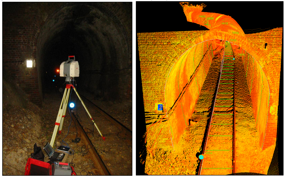
Typical TLS setup and resulting view of the point cloud (with some modelled elements shown in green)
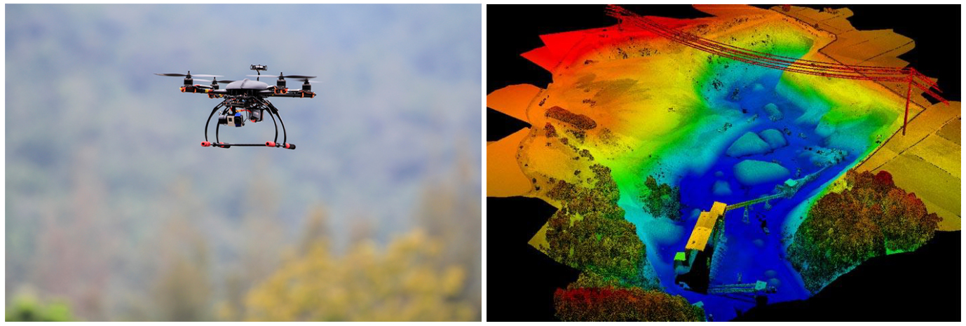
An illustration of ALS using drone and the scanned terrain geometry.
The technology consists of emitting pulsated ultraviolet, visible or near infrared light—up to millions of pulses a second, from a laser scanner to a target point and recording the time delay between transmission and point reflection. The laser light can penetrate tree cover and brush and other minor obstructions. Global Positioning System (GPS) coordinates of the lidar sensor are key to generating horizontal position, vertical elevation and other values for the target point. A “point cloud” consisting of millions of elevation data points is the resulting product. These data can then be used to map terrain and identify natural and manmade layers on the earth’s surface with each point classified to represent different surface characteristics.
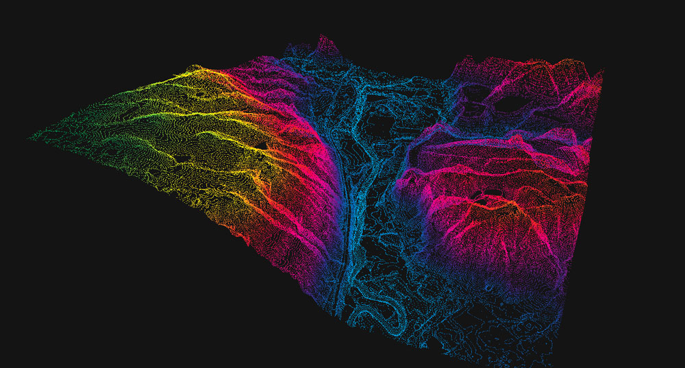
A point cloud 3D representation of a terrain.
A Flying Machine with an Edge
Lidar technology can be used in many other applications as well:
- To track threated animal populations and map their habitat;
- Assist in emergency response planning and archaeological site reconnaissance;
- To provide road data for autonomous vehicles.
Advances in UAV technology have made applications for lidar even more widespread. One recent application consists of using UAV LiDAR to measure snowpack and quantify water from snowmelt in the western U.S. mountain ranges. Water managers have long sought a more effective way to estimate water volume in the Rio Grande watershed. A UAV LiDAR scans the mountain ranges and generates elevation data before snowfall and after snowfall. Combined with spectrometer data, water managers can more precisely quantify snowmelt for hydroelectric, water supply and other purposes.
A Fast-track to Better Planning: Digital Elevation Maps
Engineering and surveying firms across the country are investing in drone technology to cut the costs of surveying and to expedite the collection of terrain data. Within a couple of hours, a bare earth digital elevation model (DEM) can be ready for site analysis and project work. Federal agencies see the potential to tackle large-scale national infrastructure projects. The USGS (United States Geological Survey) is working with partners to make 3D elevation data available to communities and citizens across the country.
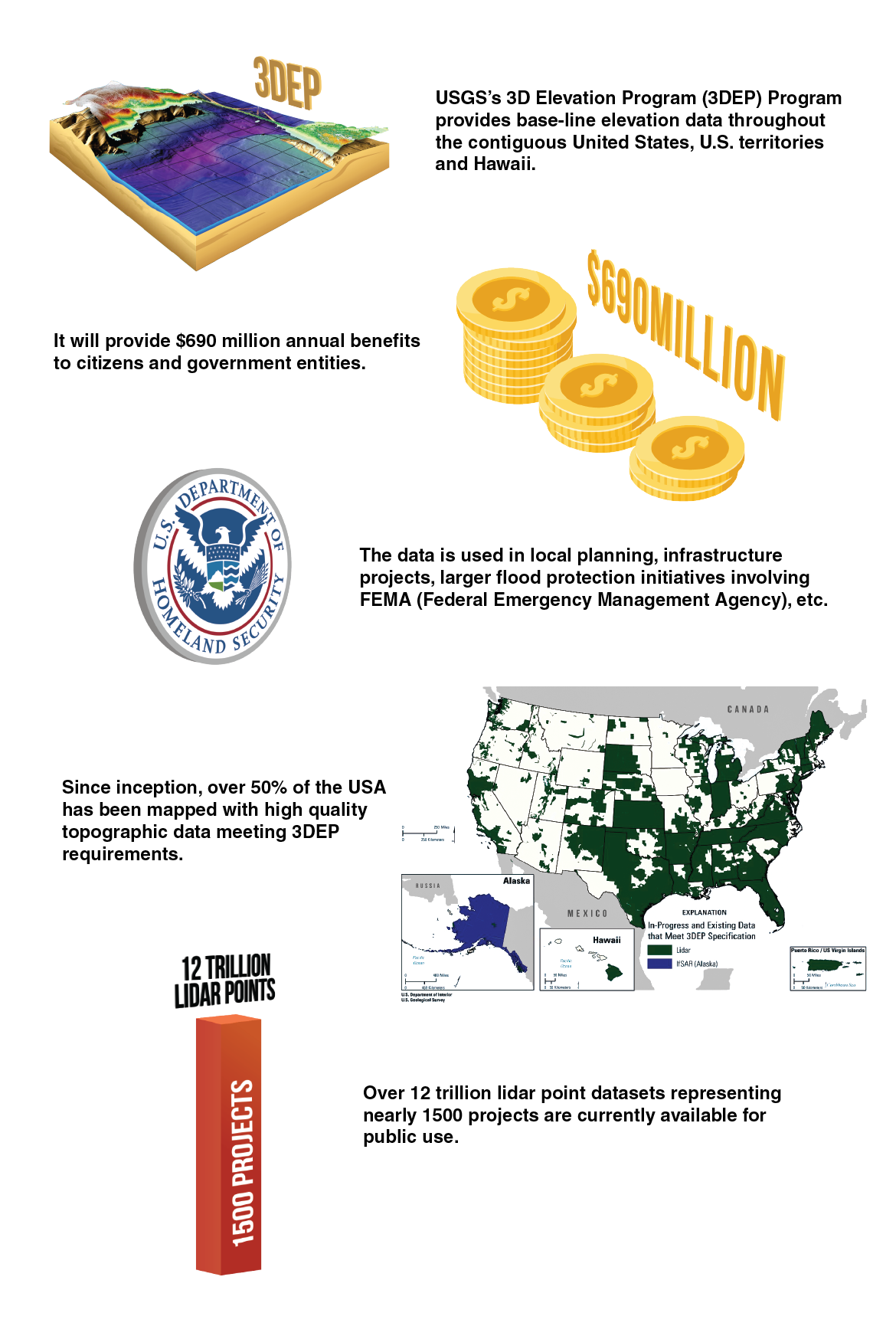
The USGS’ 3D Elevation Program (3DEP) partners with local, state and private entities to provide base-line elevation data throughout the contiguous United States, U.S. territories and Hawaii. It is projected that the program provides $690 million in benefits annually to citizens and government entities. The data is used and will continue to be used in new and innovative ways for a variety of purposes, from local planning to infrastructure projects to larger flood protection initiatives involving FEMA (Federal Emergency Management Agency). Since the program’s inception, over 50% of the nation has been mapped with high quality topographic data that meets 3DEP requirements. Through an agreement with Amazon, users now have the ability to work with vast lidar datasets in the cloud. Over 12 trillion lidar points representing nearly 1500 datasets are currently available for public use.
The Data Is Not Infallible
Just a few years ago, a lidar survey gave me the information I needed to start and complete a river floodplain mapping project in Montana. Without that data, I would have been hard pressed to even start the project. Engineers and engineering firms are poised to enter a new age, one that will benefit from the availability of high-quality baseline information at little cost. Lidar data is a bit like the long-awaited “magic pill” that makes an engineer’s job a whole lot easier. Keep in mind it is still just one (very useful) piece of the engineering problem. Highly precise lidar elevation and photogrammetry data gives you an advantage in terms of extracting river cross sections, Manning’s roughness values, flow paths, and much more. For example, you can identify off-channel storage areas where peak flows attenuate as the flood travels downstream. And, while lidar data may amp up your game, there’s still no escaping the oversight required by a conscientious engineer.